Synthetic Aperture Radar (SAR) has the advantages of high resolution imaging in all-day and all-weather, which makes it widely used. At present, China's SAR has entered the stage of practical application, playing an important role in areas such as aerial measurement, satellite remote sensing, ocean observation, reconnaissance guidance. With the development of electronic information, material structure and other technologies, UAV technology has made great progress. Because of its low price, stable safty and flexibility, UAV has been widely used in fields such as geographical mapping, emergency relief, resource exploration, and agriculture and forestry. SAR will be mounted on the UAV platform by the UAV airborne SAR. The drone could complete all-day and all-weather long-range reconnaissance, wide-area surveillance and other tasks with completely combining the two advantages.
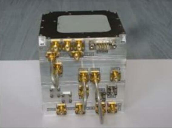
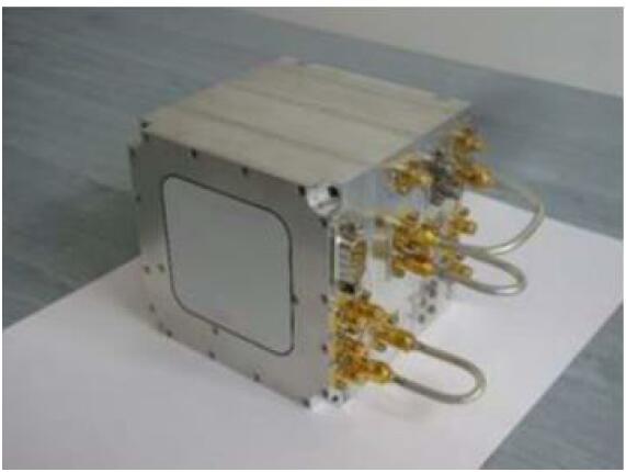
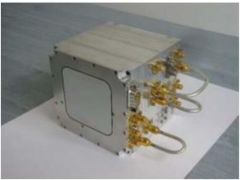
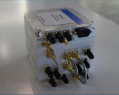
With the miniaturization and lightness of UAV, Tianjin Saride Technology Co., Ltd. has launched a series of ultralight airborne synthetic aperture radar products, including Ka, Ku, X, C, L, P and other bands, which can be mounted on UAVs, glider and tether balloons. The main components of the radar host are shown in the figure below. The maximum range of the equipment is up to 2.5km, the real-time imaging resolution is better than 0.3m, and the power is very low (less than 50W), which can be widely used in scientific research, mapping, emergency, engineering, agriculture, and forestry. For example monitoring urban subsidence, mine collapse and high-speed rail track deformation, landslide, debris flow and other disaster investigation and emergency command, earthquake prediction, real-time monitoring of water
pollution, etc.
The parameter of ultralight airborne SAR products:
| Bandwidth |
500 MHz |
| Real-time imaging resolution |
0.30 m |
| Real-time data processing |
Continuous image, strip SAR, Marine
inverse SAR |
| Max range |
2.5km |
Inertial navigation system and Global
Positioning System
(Optional GPS, GLONASS, QZSS, Beidou,
Galileo) |
3 axis acceleration sensor
3 axiss gyroscope |
| Stripe scan width |
2km |
| power supply |
28V DC |
| power consumption |
< 50 W |
| Sensor weight |
< 3 kg |
| Antenna Dimension |
30 × 5 cm |